Mapping Quality Indicators
Users may refer to the mapping quality indicators displayed on the web interface that provide live feedback during mapping to ensure the best outcome from the mapping process.
Mapping Quality Indicators
| Indicator | Description |
|---|---|
| Marker Detection | Provides feedback on the quality of the mapping of markers |
| Trajectory Coverage | Provides feedback on the quality of the coverage of an area |
These indicators allow users to know when any markers and areas of a facility have been sufficiently mapped. The indicators are shown on the main visualisation pane (trajectory and marker detections) and are also displayed in a single card at the top of the visualisation pane to give an overview of the live mapping quality.
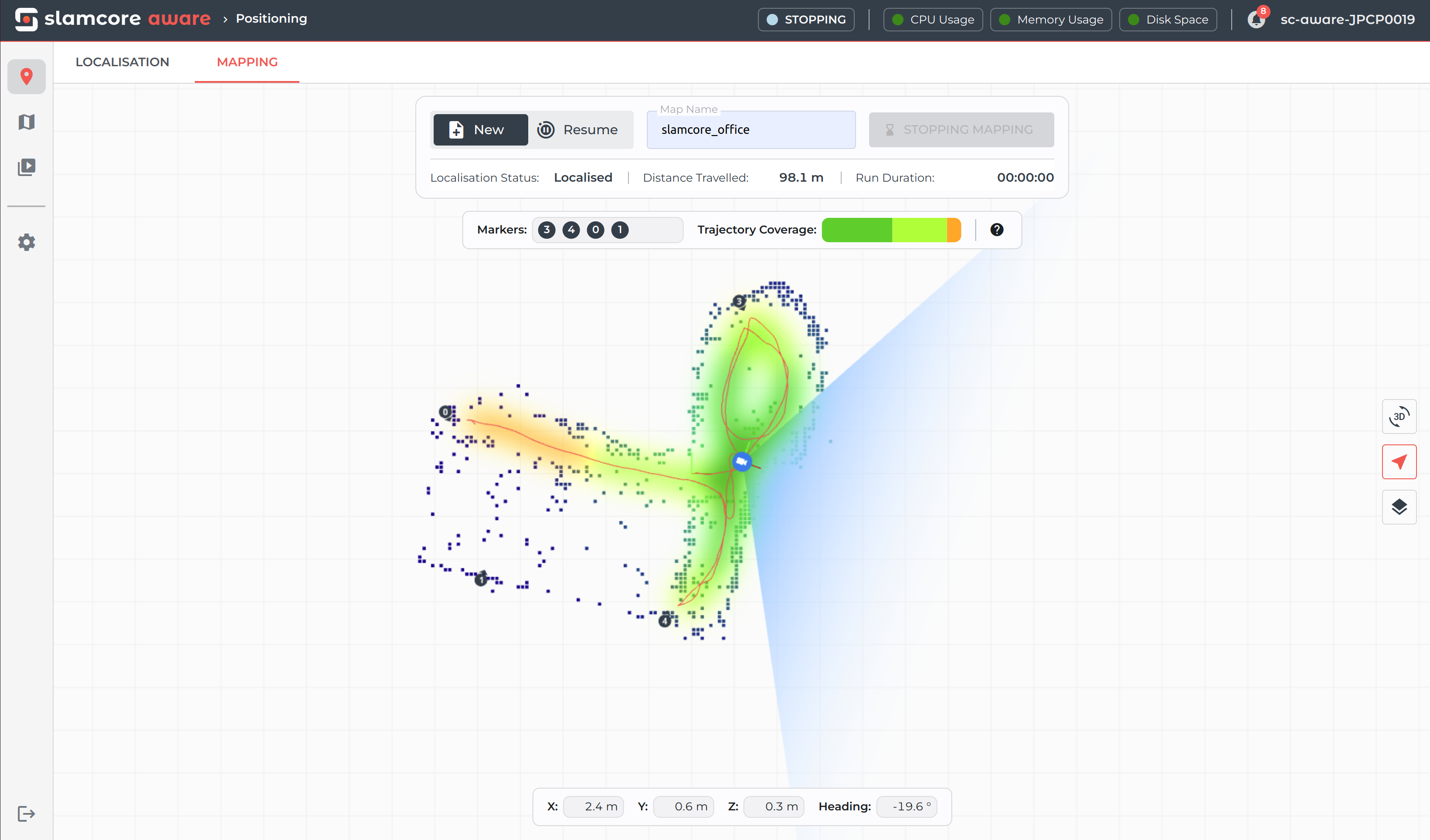
Further guidance on the meaning of the different indicators is available
by clicking on the  icon, on the right of the
mapping quality indicator card.
icon, on the right of the
mapping quality indicator card.

This will open the following modal:
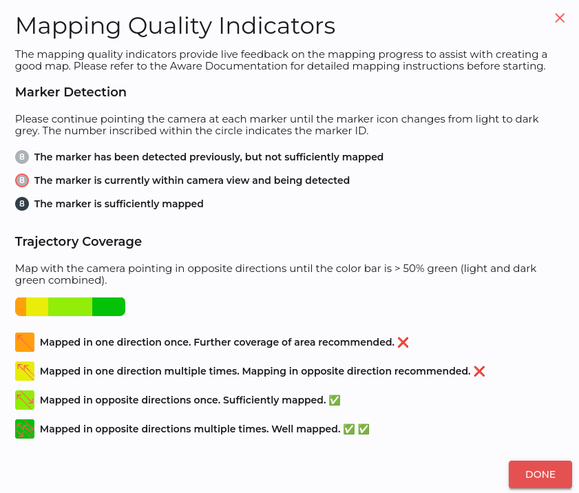
For best results, continue mapping until the following quality is achieved:
- All markers installed in the facility are sufficiently mapped and the icons have turned dark grey.
- The trajectory coverage colour bar shows at least 50% green (light and dark green combined), and a high percentage of it being dark green when possible.
The mapping quality indicators only serve to provide visual aid during the mapping run and the system does not enforce any map rejections based on the indicators. Users should aim to follow the mapping guidelines as closely as possible and monitor the live mapping quality indicators to produce a good map, which is crucial for good localisation performance.