Mapping Guidelines
Prior to the mapping procedure, ensure to first go through the Facility Setup which provides guidance on how to set up the visual marker boards used for map alignment.
When mapping the facility, we recommend following these guidelines to ensure a high quality map:
-
Drive slowly throughout the mapping process, keeping below a top speed of 8 mph or 13 km/h to minimize motion blur which may affect the mapping accuracy.
-
Drive several loops around the facility to cover the most frequently travelled routes, such as the main isles and parking bays.
- Each loop should be no more than 1km (0.6 miles) distance covered, so we recommend breaking up the facility area into zones and closing the loop in each zone before moving to the next. This allows for the system to perform frequent drift corrections along the loop.
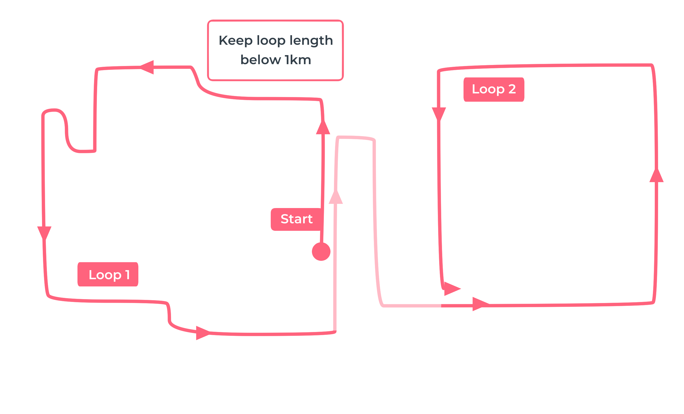
Mapping Route - Keep loop lengths below 1 km (0.6 miles) - After completing each loop, return to a previously visited location with the sensor unit facing the same direction as before and travel along the exact same path for at least 20m (65ft) before starting the loop in the next zone.
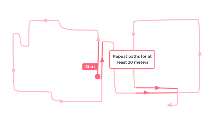
Mapping Route - Repeat a 20m (65ft) path segment for each loop - Revisit previous paths to repeat at least 50% of the driving route, but now with the sensor unit pointing in the opposite direction as before. This ensures map coverage of the visual features in both driving directions.
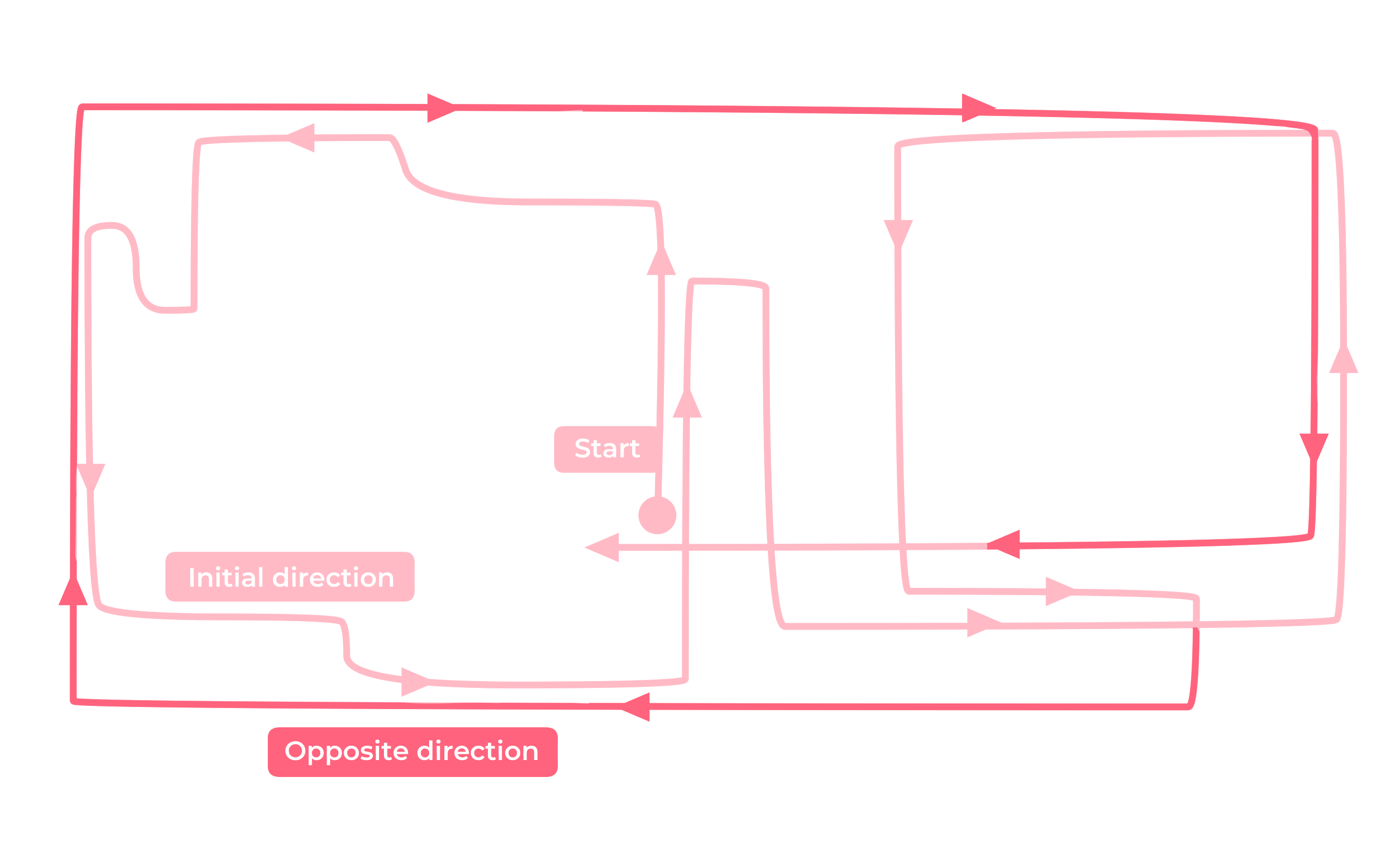
Mapping Route - Revisit at least 50% of the driving route with the sensor unit pointing in the opposite direction -
As part of the mapping route, drive up to each visual marker board with the sensor unit pointing towards the board. Try to stop close to the marker, ideally within 2m (6.5ft) away from it, before continuing the mapping process. Avoid getting closer than 30cm (1ft), if possible, to ensure the sensor unit is able to capture the whole marker within its field of view.
-
When driving through a door or gate during the mapping process, we recommend doing so with the sensor unit pointing away from the gate to minimize risk of the map getting corrupted from the movement of large objects in the sensor unit's field of view.
-
Finish the driving route back at the starting point.